Benefits
Pedestrian Space
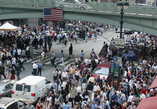
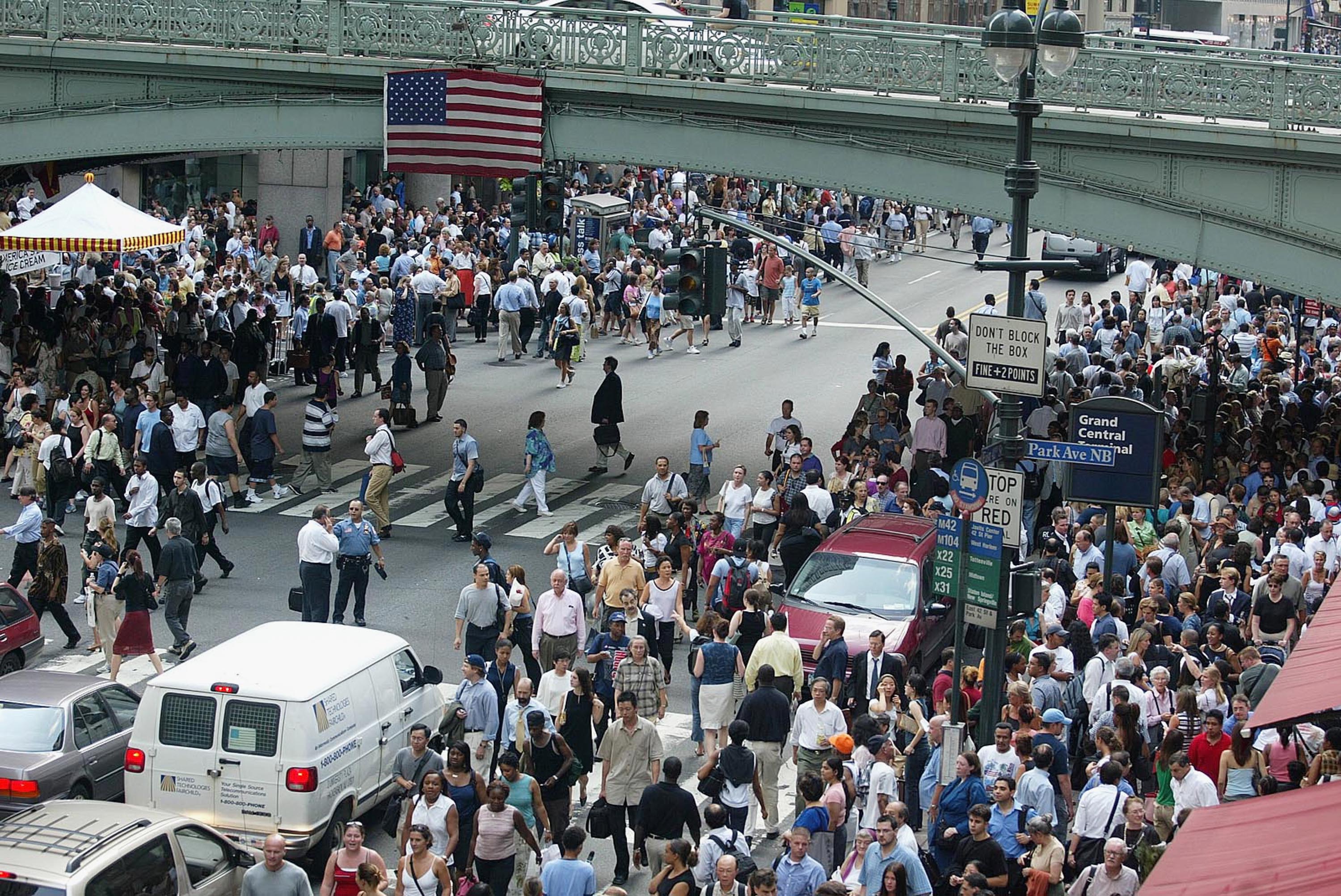
42nd Street is at the very heart of the entire region’s public transit network, but local travel on the street is dysfunctional. While pedestrians on the street currently outnumber motorists by at least five to one, some 60 percent of the street space is allocated to motor traffic. This gross imbalance is not even productive for motorists, since traffic still moves at a viscous pace. Bus travel is often as slow as 2 to 3 mph at midday.
As the population of NYC’s five boroughs increases to an anticipated 9 million by 2030 or sooner, the Mayor would make it clear that New York is serious about maintaining its continued sustainability and livability, by including the vision42 proposal as a centerpiece of the City’s long-range plans.
The 1994 light rail plan would have provided a very important upgrading to surface transit, but did not give a high priority to improving the walking environment—and this is becoming an increasingly critical issue because of the new and newly proposed developments on 42nd Street. The sidewalks become increasingly congested with every new development.
vision42 believes that the plan that was approved in 1994 would have missed a significant opportunity. Rather than retaining the westbound traffic, the current proposal is for an entire transformation of the 42nd Street environment—eliminating traffic in both directions for all but emergency vehicles and the controlled delivery of goods and refuse removal.
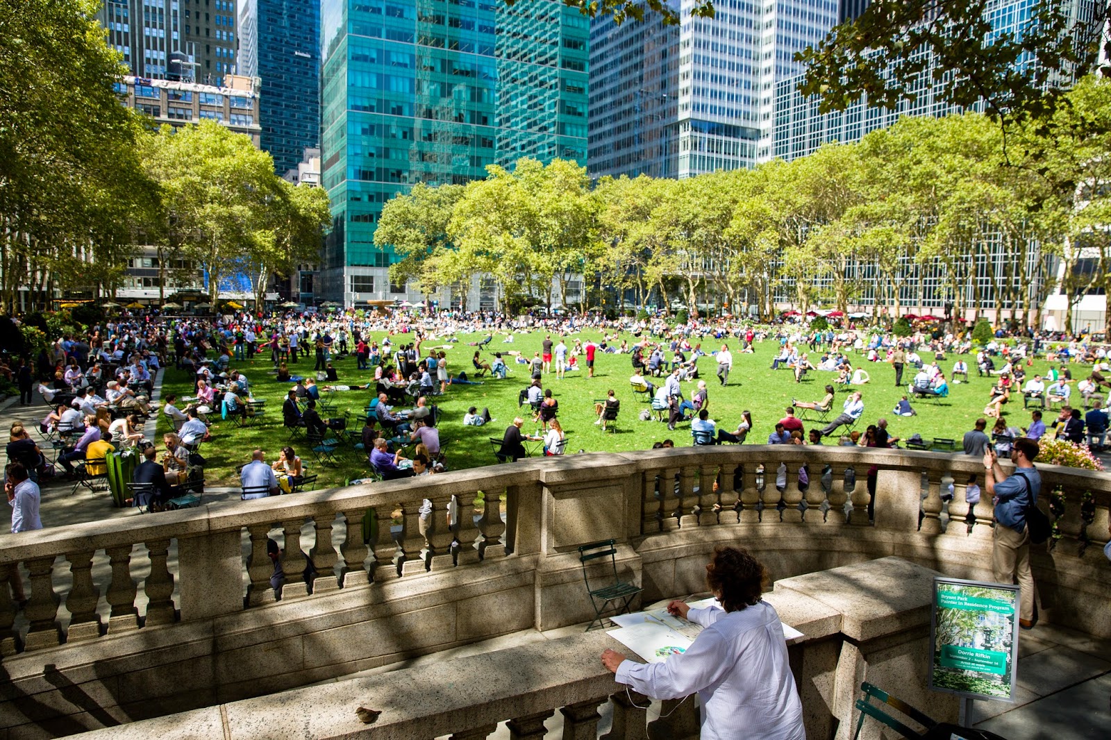
In any case it is pedestrians, not motorists, who are in a position to patronize the stores along the street. The people who work in midtown already seriously overcrowd Bryant Park, which is currently the only open public space available on the corridor. It would make very good sense, therefore, to convert street space itself into use as plazas.
Economic Benefits
Improved crosstown surface transit mobility is essential to retain the city’s attractiveness. Light rail, operating in a dedicated right-of-way, will efficiently link subways, commuter rail, express bus, and ferry systems with new high-density development along both riverfronts. And since it will do this at a relatively modest cost, it will not divert significant resources from the rebuilding of Lower Manhattan — which obviously must be the City’s priority for near-term investment.
The detailed studies by the Urbanomics team of the economic and fiscal implications of vision42 shows a highly beneficial cost-benefit ratio, indicating a clear means of funding the light rail line. It projects $1.0 billion of increases in commercial property values along the 42nd Street corridor as a result of improved crostown accessibility, as well as annual economic and fiscal benefits of $886.3 million — which far exceed the total capital cost of the light rail and pedestrian street, projected at $411.3 to $582.2 million (in 2007 dollars). Travel time savings and their effect on retail, tourism, and real estate values and rentals, including an anticipated 35% increase in retail and restaurant business, were weighed against any extra costs, such as those for deliveries, to individuals and businesses. The reports include interviews of key members of the NYC real estate industry and business owners and managers, as well as surveys of the experiences of other cities in North America and Europe. The full reports by Urbanomics, and those by Halcrow, Inc. (cost and construction phasing) and Sam Schwartz, PLLC (traffic and delivery truck parking) are posted on this website.
With the City’s economy facing serious budget shortfalls, the vision42 proposal appears more compelling than ever. Besides being affordable, vision42 can be done quickly, with splendid effects. A “first stage” could be done nearly immediately. Other projects, no matter how worthy, will take a long time to complete.
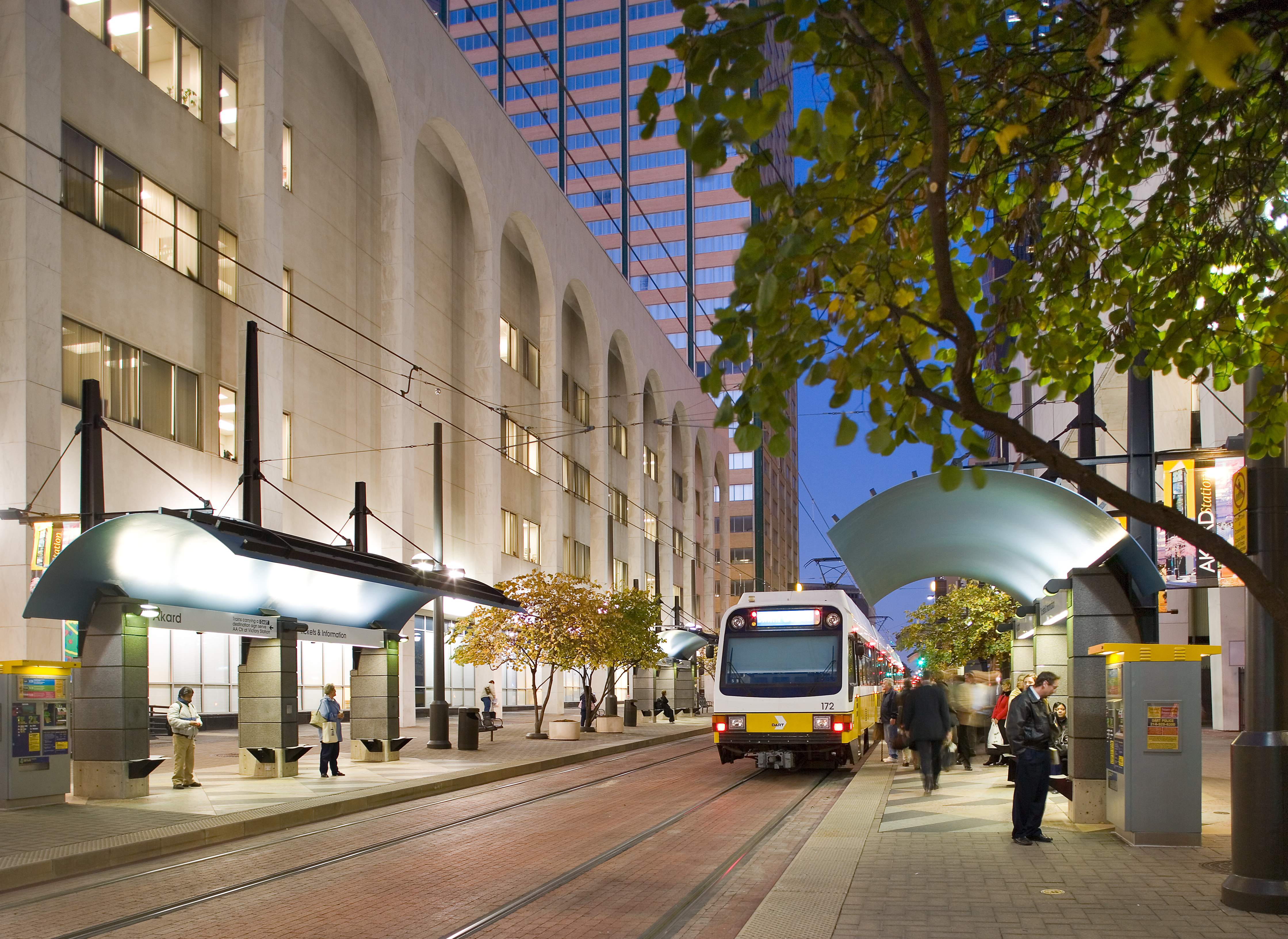
In Dallas, property values around stations have risen by about 25% since its light rail line began operating in 1996. Whereever the light rail’s been built, business development has followed. In fact, the business community has been behind the four-fold expansion of the system. which will be 96 miles when complete.
An example of urban prosperity induced by well-integrated light rail is seen in Zürich’s principle shopping boulevard, Bahnhofstrasse. Light rail runs at grade for its entire length, and for most of it’s length, it’s completely auto-free. With the main railroad station located at the northern end of Bahnhofstrasse, and a ferry dock at the other end, the street’s light rail fully integrates city and regional transportation systems of all kinds — which makes it an excellent model for 42nd Street.

Future Extensions
Light rail is a very flexible mode which is easily extended. Successful conversion of 42nd Street into an auto-free light rail boulevard could ignite public interest in further extensions of the system, such as the “Midtown Crossing” loop proposed by the Regional Plan Association, in its Third Regional Plan, which would extend the light rail east from the Convention Center along 34th Street, and up Broadway to Lincoln Center.
Another option, a 42nd Street/34th Street light rail loop, could interface beautifully with ferry service, while serving sites for projected new high-density development along the riverfronts that are a long walk from other rail transit.
Other possible extensions could follow, either with or without varying degrees of traffic restraints, landscaping, and pedestrian amenities. Initially, the light rail could have its maintenance shops within the existing Hudson Rail Yards. With extension of the system, it could ultimately reach other potential sites for maintenance shops at more remote locations.
The Global Picture
Cities have been given a bad rap by those who object that congestion rises as a function of density. But the underlying reality is that congestion depends very much upon transportation mode. The automobile commands some 25 times as much space as a human being, and much more than that when it’s in motion — the higher the speed, the greater the space.
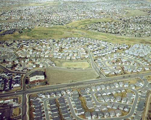
This grossly inflates the scale of transportation infrastructure and severely impacts our cities. It also leads inexorably to urban sprawl, an enormously wasteful expansion in terms of both energy and raw materials. About one-half of urban sprawl is due to population growth, but the other half is due to the overblown scale of automobile-dependent development — to the land consumed per person.
We have a very large country, which gives people the perception that they can simply move away from the difficult problems. Our inventory of cars has been growing twice as fast as the human population, as has the average lengths of trips. As a result, our consumption of oil per person in the U.S., and accompanying production of greenhouse gases, is five times greater than that of the average person in the rest of the world. Our addiction to oil for fueling all this travel not only makes us increasingly vulnerable economically, but has profound effects on our foreign policy, provoking hostilities over an ever-dwindling supply of oil.

The ecological damages of automobile-dependency are at least as pervasive. In the U.S. we are depleting farmland and forests at an unprecedented rate, losing an estimated 50 acres of prime farmland every hour, every day to urban sprawl. Largely because of loss of habitat, animal species worldwide are becoming extinct at a rate at least 100 times their normal replacement levels.
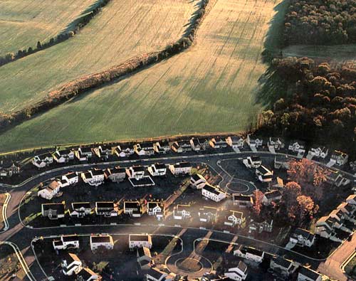
One of the most compelling reasons for containing urban sprawl is to preserve the quality of our water supply, for which forests and wetlands are normally the natural filters and cleansers. When these virgin lands are replaced with impervious surfaces, such as parking lots, roads and rooftops, stormwater becomes trapped above them and polluted on its way to underground aquifers. There is a strong correspondence between the percentage of land in a given area that is covered with impervious surfaces and the ability of water systems to regenerate themselves. The degradation of streams begins, and fish begin to disappear, when impervious cover in a watershed exceeds 10 percent of the land area. A watershed is considered generally degraded at levels above 30 percent imperviousness. Residential subdivisions with one-acre lots result typically in 10 to 20 percent impervious surfaces.
When natural filters - forests and wetlands - are replaced with urban sprawl, water systems can no longer regenerate themselves
All of which is to say that, on an increasingly populated planet, humanity needs to draw together in areas that are already built-up and therefore biologically non-supporting, and to spare our remaining open lands from further development. We therefore need plans that will make our cities more livable and workable — as high-quality alternatives to urban sprawl.
In addition to these strong environmental imperatives for well-planned urban centers, cities offer tremendous socio-economic and cultural benefits for living. As New Yorkers, we celebrate the diversity and opportunities that cities foster, just as we appreciate the health benefits of walking and using convenient public transit, versus driving everywhere. This is where the vision42 plan can serve as a persuasive demonstration of sustainable urban living — a prominent affirmation of the merits of cities.