These two rail proposals for Midtown serve very different functions and are complementary. The subway provides speedy, underground, long-distance service, while the light rail line extends the reach of the subways to the rivers, providing a fine-grained, high-quality transit and walking experience at street level to all of 42nd street’s destinations, including massive new and planned development on the far west and far east areas of Midtown that are not directly served by the subways or commuter rail.
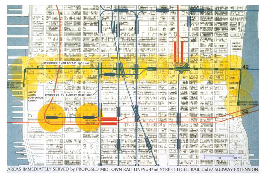
Its easy boarding and frequent access points make it an ideal collector/distributor for the subways and ferries, while its placement in a pedestrian street enhances access to all the subways, including the #7. Shown in Map A below is the route of the #7 extension as it was originally proposed, passing deep under Eighth Avenue and stopping at Penn Station before turning west to a terminus at the Hudson Yards.
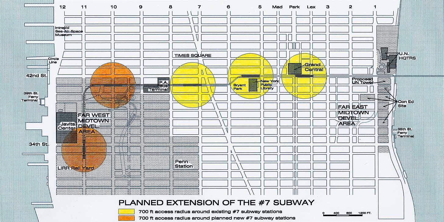
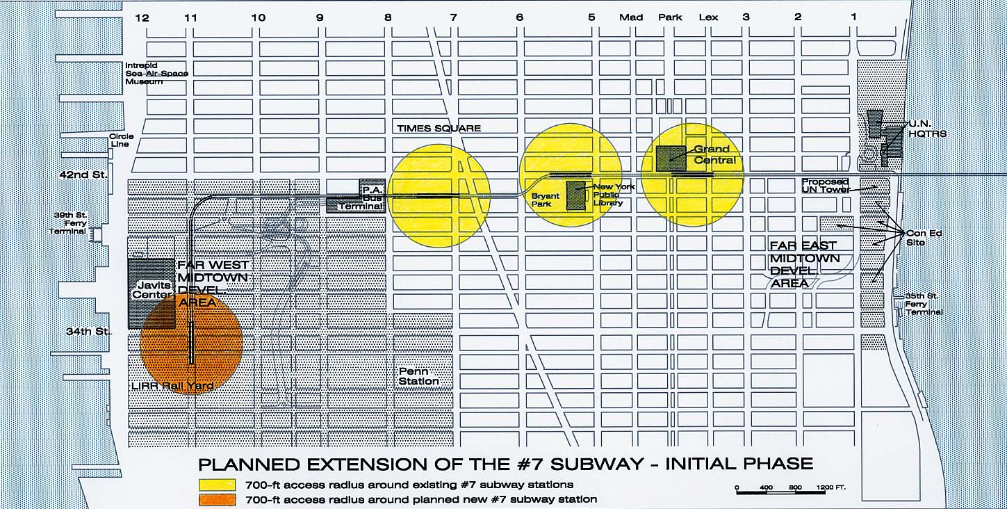
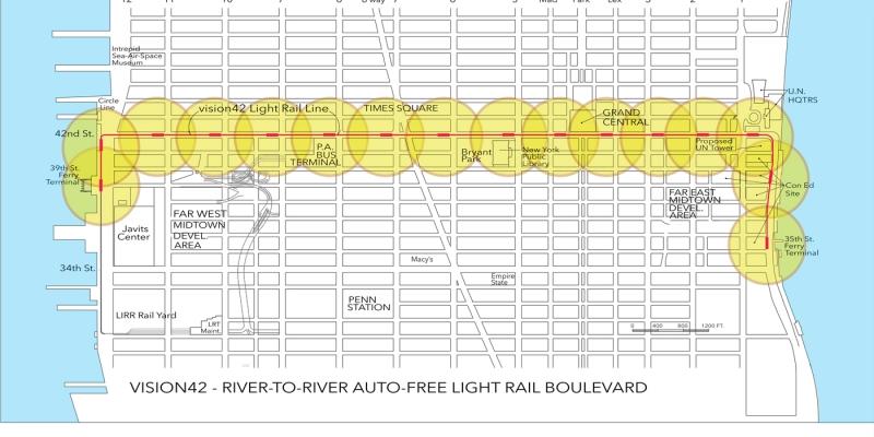
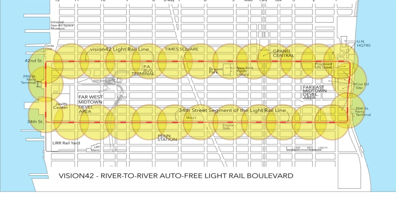
The yellow and orange circles in the maps below represent a 700-foot radius of immediate impact of each station.
Map A: This earlier plan by the City for the #7 extension, contrasts the very different travel needs that are served by these proposals. Because of the steep grade on the #7 subway line as it descends to cross under the East River, an additional station cannot be added at First Avenue to serve the UN Headquarters or the massive new development planned for the Con Ed sites. The light rail extends access to both waterfronts, serving developments that are planned along both the East and Hudson Rivers— thereby meeting needs for improved crosstown transit in a comprehensive way.
Maps B and C show the City’s current plans for the #7. No longer connecting with Penn Station, it will continue from its present Times Square terminus, along 41st Street to, and then south to a new terminus under 33rd Street between 10th and 11th Avenues. (A station that was originally planned at 10th Avenue and 41st Street has been found to be too expensive.) The entire extension is part of a plan for major new development, dominantly commercial, but including residential, in the area surrounding the LIRR West Side rail yards.
Maps D and E show the proposed alignment and station locations for the light rail transitway. On the west, the 42nd Street light rail line would turn south on 12th Avenue at 42nd Street and terminate at the new ferry terminal at 39th Street and 12th Avenue. On the east, it would turn south at the FDR Drive and terminate at the planned new ferry terminal at 35th Street.
But light rail is easily extendable. In a second phase, it could form a continuous two-way 42nd/34th Street loop —linking Penn Station with the Javits Center and Midtown Manhattan’s many tourist attractions. Efficient connections to ferries will help advance current waterfront projects along the riverfronts, not only in Manhattan, but in Queens and New Jersey.


